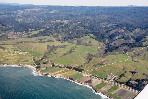
NW of Warrenella Road
Looking into the proposed Santa Cruz Redwoods National Monument from the coast. From the foreground, lower left: A block of houses NW of Davenport, on Highway 1. Warrenella Road, leading up the ridgeline. Agua Puera Creek. Swanton Road cuts off of Highway 1, crossing Molino Creek toward the left of the frame. The fields along Swanton Road, after the big bend, are out of the BLM lands, out of the proposed monument: the NW boundary. The proposed monument runs up to the ridgeline; much of the land beyond is also protected. Thanks, Derek Hine, for the airplane ride!


