Thank you for your patience while we retrieve your images.
Taken 20-Mar-15
Visitors 0


6 of 30 photos
Thumbnails
Info
Photo Info

Dimensions6000 x 4000
Original file size3.53 MB
Image typeJPEG
Color spacesRGB
Date taken20-Mar-15 10:52
Date modified19-Jul-24 16:10
Shooting Conditions

Camera makeNIKON CORPORATION
Camera modelNIKON D7100
Focal length18 mm
Focal length (35mm)27 mm
Max lens aperturef/3.5
Exposure1/180 at f/9.5
FlashNot fired, compulsory mode
Exposure bias0 EV
Exposure modeAuto
Exposure prog.Aperture priority
ISO speedISO 100
Metering modePattern
Digital zoom1x
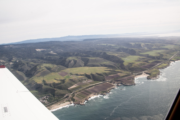
Southeast Portion

Southeast Portion

From the left, four steep riparian valleys: a peak at San Vicente Creek just behind the wing, with a few Davenport houses near Highway 1; Bonny Doon Road runs up West Liddell Creek; Yellow Bank Creek; & Laguna Creek jus at the right of the frame. Laguna Creek is right near the SE boundary of the proposed Santa Cruz Redwoods National Monument.