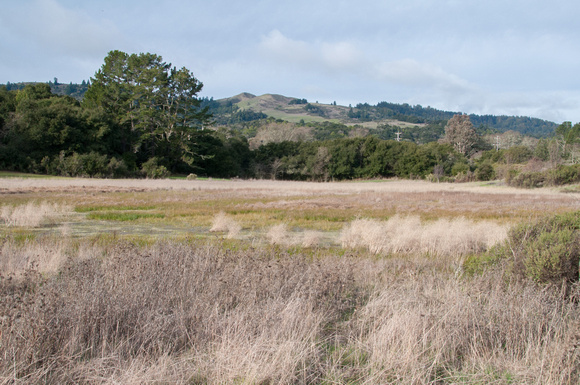
Windy Hill from Frog Pond
Water in the Frog Pond in January. Windy Hill is green. 1/29/2011. br/br/Our Frog Pond is a sag pond. Here is more info:br/br/"Sag ponds were once explained to me as being caused by solid vertical "curtains" of clay along the seam of faults: rain falls and soaks into the ground. Gravity keeps the water flowing downhill underground; it will eventually collect in a valley and reappear as surface water in a creek. Unless it hits a clay-lined fault seam. br/br/"Sag ponds are created when that underground water movement is interrupted by the vertical waterproof curtain of clay at the fault line (the clay being formed of tiny particles of soil that have been ground exceedingly fine through eons of friction as the faults slide). The water can't get through so it backs up and become a column of water uphill of the fault. When the column is full, the water appears at the surface as a small lake/pond with one straightish edge (along the fault side) and roundish shape otherwise. Thus you can deduce where the fault is when you come across an irregular small pond with one straight side in an otherwise unexpected place. They generally don't have exit creeks because there isn't enough water flow speed to erode the clay lining at the surface. br/br/"Vernal pools, on the other hand, are small ponds in flatter areas, where there isn't a distinct surface run-off pattern and rain water gathers in natural shallow depressions. They aren't always round, but they are generally of consistent shallow slope so that as water evaporates after the spring rain, a pattern of concentric rings (although not necessarily round) develops. There is an ecologically long-term pattern of air and soil warming in the spring causing a rate of evaporation/warmth (and length of daylight) that certain plants have adapted to, so as the water warms up and the pool shrinks, different plants germinate and grow. br/br/"That's what causes the multicolored concentric ring effect: one plant germinates in damp soil at 56°, another at 57°, another at 58°, etc., as the water slowly evaporates and temperatures climb (I'm making up the temperatures but I think the theory is right). Similar plants all around the edge of the pond bloom together when that level of water dries out, followed by the next temperature triggered germination, etc. br/br/br/"One reason they are special and rare is that they only occur where the crust of the ground is unbroken in geologic time. Because so much of California was used as range land and not plowed, the ancient biology hasn't been disturbed and the specially adapted plants' seeds are lying around in shallow depressions waiting for the cycle to start over after the next rains. Much of the country has had the surface soil turned in the past few hundred years, breaking the chain. (and I assume each vernal pool has specialized plants to its local spot?)br/br/"How's that, geologists and botanists?br/br/-- Carol, Portola Valley, PVForum, 2/2014br/br/"Vernal is good, cannot comment on Sag."br/br/Bill Vermeerebr/Medical Physicistbr/818.424.7910br/2/2014br/br/"Vernal pool is a general term for any temporary stagnant surface water. Often these form in Vertisols, soils rich in a type of clay mineral (smectite) that swells upwards of 40% in the presence of water, expanding against itself, and sealing off any avenues for downward percolation of water.br/br/br/Sag ponds are caused by denudation (sinking) of land in response to a bend in a fault. This type of bend is known as a releasing bend. They come in many sizes. A large bend of the San Andreas fault to the west created the Lexington Reservoir (which is now dammed), off of highway 17 just south of Los Gatos. I can't corroborate/refute the talk of clay that was proposed in earlier posts, but the mechanics make sense to me.br/br/The opposite type of bend in a fault, a restraining bend, is responsible for most of the small hills and ridges in our area. A large bend in the San Andreas is responsible for the San Gabriel mountains in Los Angeles. br/br/-Matt, posted a little earlier, 2/2014