Visitors 45
Modified 21-Dec-23
Created 10-Sep-21
95 photos
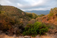
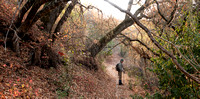
What a pleasure, to explore Jasper Ridge with an accomplished botanist. He wanted to catalog the plants at several remote serpentine seeps, and needed a partner. I was the lucky one – I got to explore new places, for me. It was a beautiful day: grey skies, some wind, thin sunlight forcing its way through the clouds occasionally, with wonderful glowing light.
My companion, John Rawlings, wanted to check for some rare plants seen elsewhere on the Peninsula, as well as check the condition of several serpentine seeps he has visited in the past. Starting at the Sun Research Center, we walked up past the Shack and to Trail b.
From here on, just for fun, I am going to refer to this as the Irene Brown Trail (Trail b). After her PhD. with Paul Ehrlich, Irene remained connected to Jasper Ridge for over 40 years. Her research focused on the Chalcedon Checkerspot Butterfly (Euphydryas chalcedona, AKA Variable Checkerspot). The Irene Brown Trail was one of her main research locations. She documented butterflies and larvae, tagged butterflies to watch their dispersal, and investigated the reasons for the survival of E. chalcedona at Jasper Ridge, after the local extinction of the related Bay Checkerspot Butterfly (E. editha bayensis). She pioneered this trail and the trail extensions that John and I explored today.
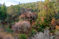
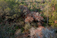
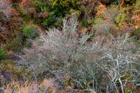
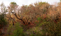
John led me along the Irene Brown Trail to its uncertain ending, then up and through the chaparral and forest, and to the first of the serpentine seeps. Later, after winding around and a bit of bushwhacking, we emerged on the grassland below Road F, near the Blue Oak Forest on the ridge, and visited another seep. Crossing the road and the Birding Transect Trail (location of a long-running bird survey), we found yet another serpentine seep. We returned via Road F and the dam.
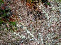
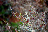
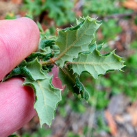
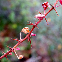
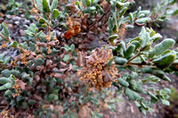
Jasper Ridge sits at the edge of the North American tectonic plate. As the Pacific Plate dives underneath, interesting minerals are squeezed up to the surface like toothpaste -- including serpentine rock, produced under high pressure but lower temperature by metamorphosis from surface rocks which have descended deep in the earth. Soil with serpentine is poor in calcium and other major plant nutrients, but rich in elements toxic to plants such as chromium and nickel. Thus, only a limited number of plants grow there -- mostly local native plants, which have had eons to evolve here. The water in serpentine seeps also flows beneath the surface, then back up – but on a very different time scale. Serpentine seeps often have springs or flowing water, leading to a more-distinct ecosystem. But, in this second year of drought, the plants at these serpentine seeps may be under special stress. [Bob Dodge has assembled local rainfall records for the past 129 years. We have just experienced the lowest one- and two-year seasonal rainfall total in all that time*.]
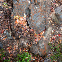
For me, the most disturbing sight was decades-old moss – perhaps even centuries old -- crumbling and falling down a dry serpentine seep.
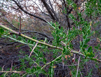
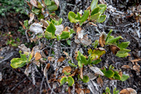
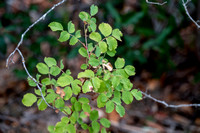
But there were signs of adequate water elsewhere: a large patch of California Rose, a Californica Buckeye with still-green leaves.
Included at the end of this collection are a few photos from Searsville Lake etc. from before and after John began his serious botanizing. In addition to guiding the expedition and pointing out interesting and rare plants, John also inspected my photos and supplied additional IDs. Bob Dodge also contributed IDs.
Thanks!
* The rainfall season is July 1 to June 30. June 30, 2021 marked the lowest two-year local rainfall total in 129 years: 11.5” (2020) and 8.5” (2021). The next lowest two-year period was in the drought of 1976-77: 10.4” and 12.5”. The 8.5” rainfall for the year ending June 30, 2021 was drier than the next lowest (1976) by almost 2 inches: setting a new record, a full 18% below the previous! (Bob Dodge, communication via JR Chat, 8/9/2021.
* The rainfall season is July 1 to June 30. June 30, 2021 marked the lowest two-year local rainfall total in 129 years: 11.5” (2020) and 8.5” (2021). The next lowest two-year period was in the drought of 1976-77: 10.4” and 12.5”. The 8.5” rainfall for the year ending June 30, 2021 was drier than the next lowest (1976) by almost 2 inches: setting a new record, a full 18% below the previous! (Bob Dodge, communication via JR Chat, 8/9/2021. And we could be in for yet another dry year!)
Category:Scenic
Subcategory:Landscapes
Subcategory Detail:
Keywords: